Three Peaks Challenge Route Guide: 24-Hour & Multi-Day Options
Dreaming of standing on the roof of every UK nation, but unsure which three peaks challenge route is right for you? You're not alone. Many aspiring hikers get overwhelmed by conflicting advice about route order, timing, start points, and whether to attempt the famous 24-hour format or take a more relaxed multi-day approach. Whether you're a first-timer or returning to improve on a previous attempt, choosing the right route is the single most important planning decision you'll make.
This guide breaks down everything you need to know about three peaks challenge route options including peak-by-peak start points and distances, how to choose between the 24-hour and multi-day formats, driving routes between peaks, and the key tips that make the difference between a smooth summit and a stressful scramble. No jargon, no guesswork just clear, practical guidance for hikers of all experience levels. For a full overview of the challenge including training and kit, visit our complete National Three Peaks Challenge guide.
Understanding the Three Peaks Challenge Route
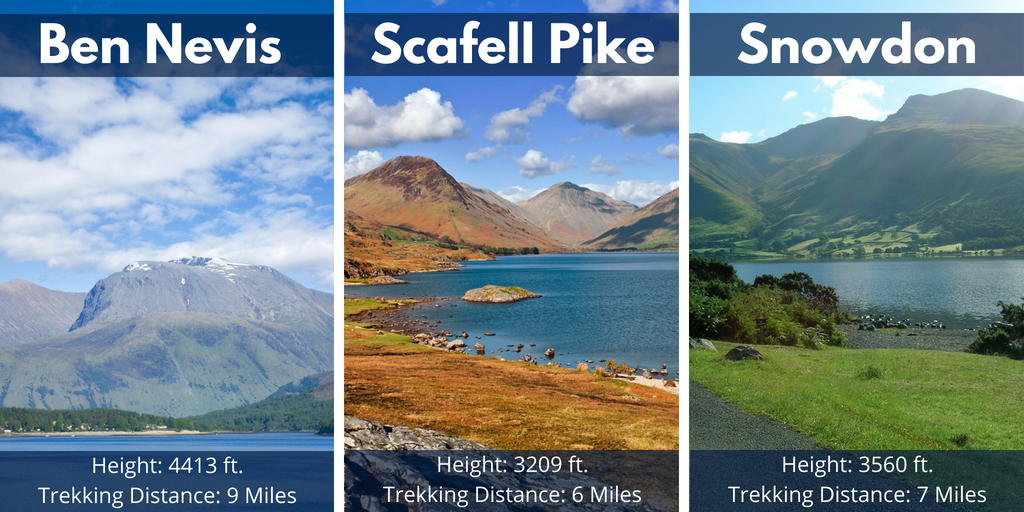
The National Three Peaks Challenge involves summiting the highest mountain in each of the UK's three constituent countries: Ben Nevis (Scotland, 1,345m), Scafell Pike (England, 978m), and Snowdon — also known as Yr Wyddfa (Wales, 1,085m). The total hiking distance across all three peaks is approximately 23 miles (37km), with a combined elevation gain of around 3,064 meters — roughly equivalent to climbing from sea level to the summit of Ben Nevis three times in a row.
The vast majority of participants tackle the three peaks challenge route in a north-to-south order: Ben Nevis first, then Scafell Pike, then Snowdon. This order is almost universally used because it follows the most logical geographic sequence down the UK's west side, minimizing total driving distance between peaks. The full driving distance between all three trailheads is approximately 462 miles, with transit time typically accounting for 10–11 hours under normal road conditions. Choosing your route start points carefully for each peak is just as important as choosing the right format.
Peak-by-Peak Route Breakdown
Each of the three mountains has a standard recommended route for challenge attempts, chosen for reliability, safety, and efficiency. Below is a detailed breakdown of each peak's recommended start point, trail, distance, and typical completion time.
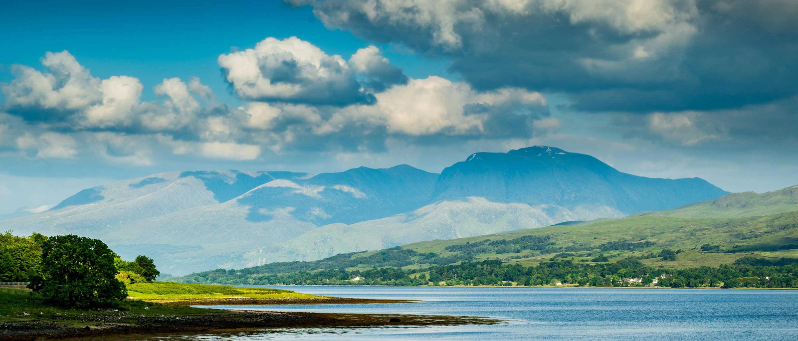
Ben Nevis (Scotland) Mountain Track from Glen Nevis
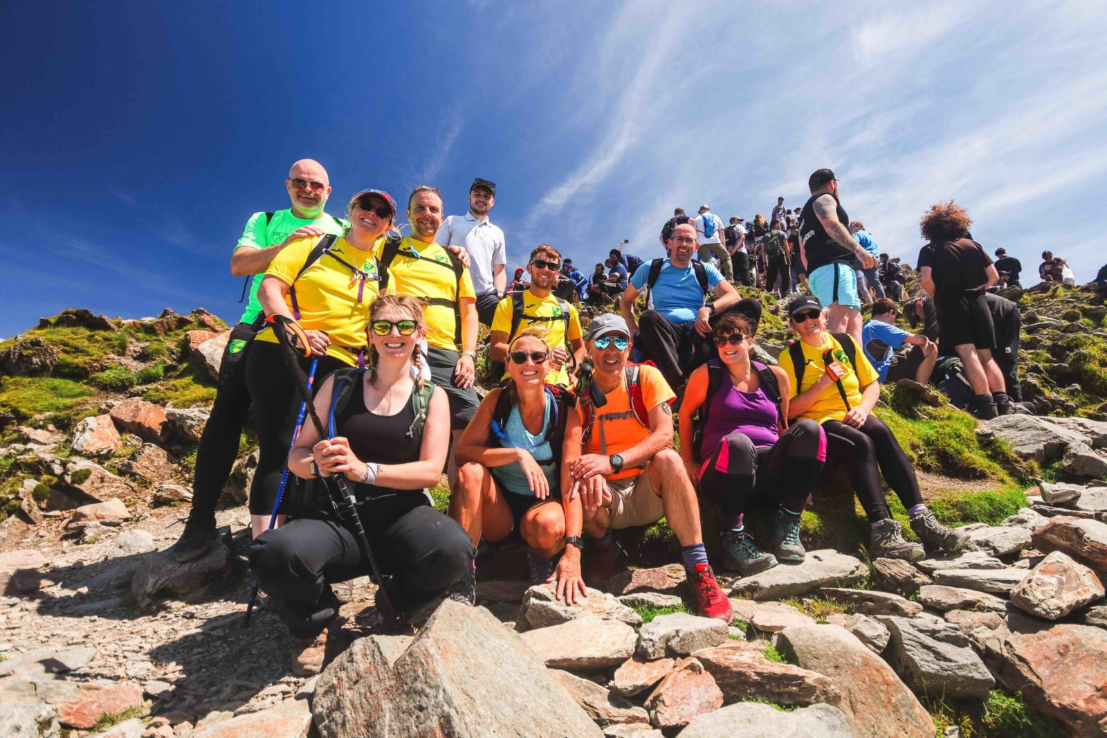
Ben Nevis is the tallest of the three at 1,345 meters and the first summit on the standard north-to-south three peaks challenge route. The recommended starting point is the Ben Nevis Visitor Centre car park in Glen Nevis, near Fort William, which sits at just 20 meters above sea level.
The route follows the Mountain Track (also known as the Pony Track) a well-maintained but steep path that gains around 1,300 meters of elevation over approximately 8 miles (13km) round trip. The lower sections can be boggy after rain, while the upper mountain features rocky terrain and a broad summit plateau that can be difficult to navigate in low cloud or mist. Average round-trip time for fit challenge hikers is 4–5 hours, though weather conditions and group pace can add significantly to this. Ben Nevis is climbed first in almost all challenge attempts it is the longest and most physically demanding of the three peaks, and tackling it in daylight makes navigation and pacing significantly safer.
Weather on Ben Nevis is famously unpredictable. Even in summer, summit temperatures regularly sit 10°C or more below the valley, and thick cloud cover is common. Always carry a map, compass, and full waterproofs regardless of the morning forecast.
Scafell Pike (England) — Wasdale Head Route
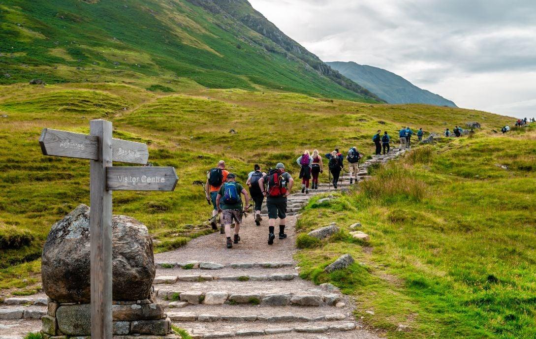
Scafell Pike stands at 978 metres the lowest of the three peaks in height, but widely regarded as the toughest climb of the challenge. The most commonly used start point for three peaks challenge route attempts is Wasdale Head, a remote valley in the Lake District with limited parking and no mobile phone signal in many areas.
The Wasdale Head route covers approximately 6 miles (9.5km) round trip with around 900 metres of elevation gain. The path is steep and technical, with loose scree slopes near the summit that demand careful footwork, particularly when legs are already tired from Ben Nevis. Average completion time for challenge hikers is 3–4 hours, though this can extend for groups tackling it in the early hours of the morning. Download offline maps before arrival and be prepared to navigate without phone signal. The car park at Wasdale Head fills quickly; for 24-hour attempts starting Ben Nevis in the afternoon, you will typically arrive at Wasdale Head between midnight and 3am.
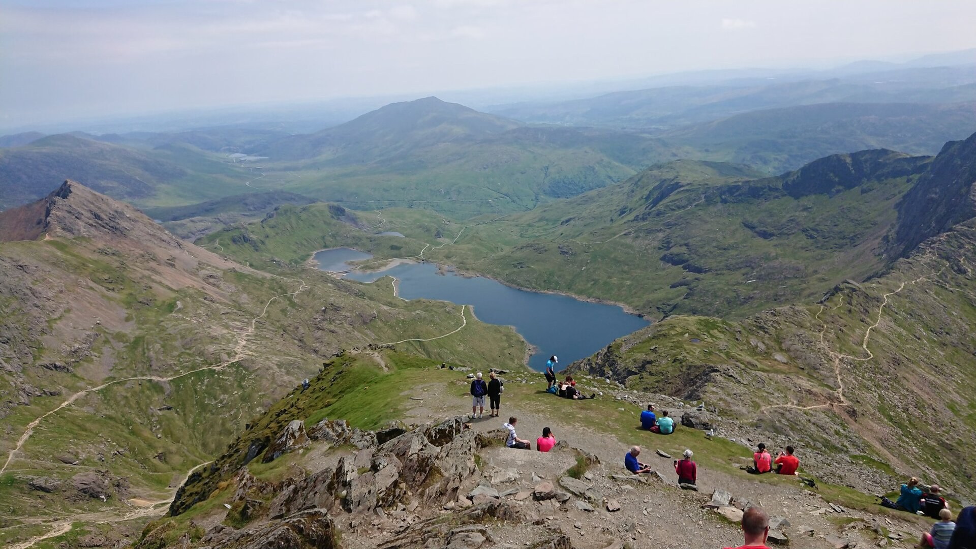
Snowdon (Wales) — Llanberis Path from Pen-y-Pass
Snowdon (Yr Wyddfa) is Wales' highest peak at 1,085 meters and the final summit on the standard three peaks challenge route. The recommended starting point for most challenge attempts is the Snowdon Mountain Railway car park in Llanberis, from which the Llanberis Path begins. This is the longest but most straightforward of Snowdon's routes, covering approximately 9 miles (14.5km) round trip with around 1,000 meters of elevation gain.
The Llanberis Path is wide, well-maintained, and clearly signposted a welcome change in terrain after Scafell Pike's loose rock. Average completion time for challenge hikers is 3.5–5 hours, though fatigue from the previous two peaks frequently slows pace on this final climb. Snowdon is the busiest of the three peaks, with heavy foot traffic even in the early morning hours during the summer season. On a 24-hour attempt, most groups reach Llanberis between 6am and 10am, so expect other walkers even at sunrise. Avoid the Crib Goch ridge route for challenge attempts it is a serious scramble with significant exposure, best left to experienced mountaineers.
Now that you know each peak's route, the key decision is which overall format suits your goals and fitness level.
Choosing Your Format: 24-Hour vs Multi-Day Route
There are two core formats for the three peaks challenge route, each with distinct demands and benefits. The right choice depends on your fitness level, experience, the makeup of your group, and what you want to get from the experience.
The 24-Hour Non-Stop Route
The 24-hour format is the most famous version of the three peaks challenge route, requiring participants to complete all three summits and the full driving distance between them within a single 24-hour window. The most common schedule starts Ben Nevis around 4–5pm on Day 1, targeting a Scafell Pike start around midnight or 1am, and a Snowdon finish by early to mid-afternoon on Day 2.
This format leaves very little margin for delays traffic incidents, slow hiking pace, or a weather hold on any peak can quickly put the finish time under threat. Participants should expect to hike for a total of 12–15 hours across the three peaks, combined with 10–11 hours of driving. Sleep during this format is typically limited to short naps in the support vehicle during transit. The 24-hour route is genuinely demanding and requires a proper training plan, ideally begun 8–12 weeks before your challenge date. For detailed preparation guidance, see our National Three Peaks Challenge training guide.
The 24-hour format is best suited to: experienced hikers with good mountain fitness, groups with dedicated drivers who can take turns, and teams with a clear charity or fundraising target that benefits from the challenge format's profile.
The Multi-Day Leisurely Route
The multi-day format spreads the three peaks challenge route across two or three days, allowing full nights of sleep between summits. A typical two-night itinerary involves climbing Ben Nevis on Day 1, staying overnight near the Lake District, ascending Scafell Pike on the morning of Day 2, driving to Snowdonia, and completing Snowdon on Day 3.
This format has a significantly higher success rate than the 24-hour version, as participants are not hiking on cumulative sleep deprivation or extreme physical fatigue. It also gives more time to appreciate the scenery at each summit and recover properly between peaks. The multi-day route is ideal for: beginner to intermediate hikers, groups with mixed fitness levels, families or older participants, and anyone who wants to genuinely enjoy the experience rather than race the clock. There is no single "official" multi-day schedule groups can adapt timings to suit their pace, accommodation availability, and weather windows. BookItList offers a fully guided 3-day National Three Peaks Challenge with accommodation, transport, and expert mountain guides included.
Driving Routes Between Peaks
The driving sections of the three peaks challenge route are as important to plan as the hiking itself. Poor route choices, unexpected roadworks, or underestimating drive times are among the most common reasons 24-hour attempts go over time.
The drive from Glen Nevis (Ben Nevis) to Wasdale Head (Scafell Pike) covers approximately 264 miles and typically takes 5.5–6.5 hours under normal conditions, following the A82 south from Fort William before crossing into England via the M6. The drive from Wasdale Head to Llanberis (Snowdon) covers approximately 175 miles and takes around 3.5–4.5 hours, travelling south through the Lake District and across into North Wales via the A55. Both legs involve significant sections of single-track or narrow country roads near the trailheads themselves build extra time into your schedule for these sections, particularly at night.
Key driving tips for the three peaks challenge route: pre-download offline maps for all driving sections before you leave home, rotate drivers every two hours to prevent fatigue, plan fuel stops in advance as petrol stations near Wasdale Head are extremely limited, and always add at least 30–45 minutes of buffer to each drive estimate for unexpected delays.
Top Tips for Completing Your Route Successfully
Even with the right route planned and solid fitness behind you, small oversights can derail a three peaks challenge attempt. Follow these core tips to maximize your chances of a safe, successful finish:
Start Ben Nevis at a conservative, sustainable pace it is the longest climb, and burning too much energy early will cost you significantly on Scafell Pike and Snowdon. Many experienced groups maintain a pace on Ben Nevis that feels almost too easy, knowing the cumulative fatigue that lies ahead.
Check mountain weather forecasts for all three locations separately in the 24 hours before your start. Ben Nevis, the Lake District, and Snowdonia each have distinct microclimates a clear forecast for one does not guarantee conditions at another. The Met Office Mountain Forecast is the most reliable source for summit-level conditions in the UK.
Share your full itinerary including route start points, expected summit times, vehicle registration, and emergency contact details with a trusted contact not participating in the challenge. Carry a personal locator beacon or satellite communicator, particularly for Scafell Pike's remote approach.
Eat consistently throughout the challenge even when you don't feel hungry. The combination of sustained physical effort and disrupted sleep suppresses appetite, but you will be burning through energy reserves rapidly aim for a small snack every 30–45 minutes on the trail.
For first-time participants, considering a guided challenge removes the logistics and navigation burden, allowing you to focus entirely on the physical achievement. A guided option also provides experienced mountain leaders familiar with each route in all weather conditions.
Frequently Asked Questions
Q: What is the standard three peaks challenge route order?
A: The vast majority of attempts follow a north-to-south order: Ben Nevis first, then Scafell Pike, then Snowdon. This minimises total driving distance and allows Ben Nevis the longest and most demanding climb to be tackled in daylight.
Q: How long is the three peaks challenge route in total?
A: The combined hiking distance across all three peaks is approximately 23 miles (37km), with around 3,064 metres of total elevation gain. The driving distance between all three trailheads is approximately 462 miles.
Q: What are the recommended start points for each peak?
A: Ben Nevis: Glen Nevis Visitor Centre, near Fort William. Scafell Pike: Wasdale Head, Lake District. Snowdon: Snowdon Mountain Railway car park, Llanberis.
Q: Can I do the three peaks challenge route in reverse order (Snowdon first)?
A: Reverse-order attempts are occasionally undertaken, but they are significantly less common. The south-to-north route is logistically less efficient and means tackling Ben Nevis the longest climb at the end, when fatigue is at its highest. The standard north-to-south order is strongly recommended, particularly for first attempts.
Q: Do I need a guide for the three peaks challenge route?
A: Guides are not mandatory, but are strongly recommended for first-time participants for navigation safety, logistics management, and support throughout the challenge. See our full challenge guide for more information on guided options.
To summaries, the standard three peaks challenge route follows a north-to-south order Ben Nevis, Scafell Pike, then Snowdon covering approximately 23 miles of hiking and 462 miles of driving between trailheads. Choosing between the 24-hour and multi-day format is the most important decision you'll make as you plan your attempt, and the right answer depends entirely on your fitness, experience, and goals. With the right route knowledge, a realistic schedule, and proper preparation, the National Three Peaks Challenge is one of the most rewarding hiking achievements available in the UK. Unsure if the 24-hour format is right for your fitness level? Our guide on how hard the National Three Peaks Challenge really is will help you decide.
Ready to take on the Three Peaks Challenge? Book your guided 24-hour attempt with BookItList and start your adventure today!